


وصف لـWeather & Radar India
Key Features of Weather & Radar India app:
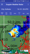
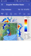
• India live Doppler weather radar Images.
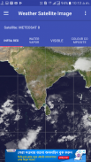
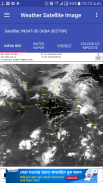
• Indian Sector Satellite Images.
• Every 10 minutes radar image updated.
• 24 India city's Doppler Weather Radar Images.
• Change your desire city and see the clouds position.
• Insat 3D, Insat 3DR and Meteosat-8 Satellite Images.
Doppler Weather Radar Image Features:
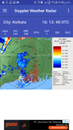
• MAX(Z) => Maximum Display(Z) -This radar image gives the clouds position with cloud height within 250 KM range.
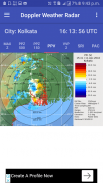
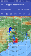
• PPZ500 => Plan Position Indicator(Z) -This radar image gives the clouds position within 500 KM range.
• PPZ150 => Plan Position Indicator(Z) -This radar image gives the clouds position within 150 KM range.
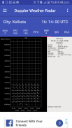
• PPV => Plan Position Indicator(Radial Velocity) -This radar image gives the clouds radial velocity within 250 KM range. The radial velocity towards radar site is taken as negative value (-ve) and away from radar site is taken as positive value (+ve).
• VVP2=> Volume Velocity Processing 2-This radar image gives the direction and radial speed of winds in different standard layer/height from surface.
• SRI – Surface Rainfall Intensity -This Image is an image of the rainfall intensity in a user selected surface layer within 100 KM range.
• PAC - Precipitation Accumulation -This Image shows the total rainfall amount in (mm) within 24 Hours. 250 KM range.
This App gives you the easy access and quick view of clouds over your city from Doppler weather radar images and satellite images published by India Meteorological Department.
الميزات الرئيسية الطقس والرادار الهند التطبيق:
• الهند دوبلر الحية رادار الطقس صور.
• صور الأقمار الصناعية للقطاع الهندي.
• تحدث كل 10 دقيقة صورة الرادار.
• 24 مدينة في الهند دوبلر الطقس الرادار الصور.
• تغيير المدينة رغبتكم ونرى الموقف الغيوم.
• انسات 3D، انسات 3DR ومتيوسات 8 صور الأقمار الصناعية.
دوبلر رادار الطقس صورة الميزات:
• MAX (Z) => العرض الأقصى (Z)، هذا صورة الرادار يعطي موقف الغيوم مع ارتفاع سحابة ضمن 250 مجموعة KM.
• PPZ500 => الخطة الوظيفة المؤشر (Z)، هذا صورة الرادار يعطي موقف الغيوم ضمن 500 مجموعة KM.
• PPZ150 => الخطة الوظيفة المؤشر (Z)، هذا صورة الرادار يعطي موقف الغيوم ضمن 150 مجموعة KM.
• PPV => الخطة الوظيفة المؤشر (شعاعي السرعة)، هذا صورة الرادار يعطي الغيوم السرعة الشعاعية داخل 250 مجموعة KM. يؤخذ السرعة الشعاعية نحو موقع رادار كقيمة سلبية (هاء)، وبعيدا من موقع الرادار تؤخذ كقيمة إيجابية (+ هاء).
• VVP2 => حجم معالجة سرعة 2-هذه الصورة الرادار يعطي الاتجاه وشعاعي سرعة الرياح في طبقة معايير مختلفة / ارتفاع من سطح الأرض.
• SRI - المساحة شدة المطر، هذا صورة هي صورة لكثافة هطول الأمطار في الطبقة السطحية المحددة من قبل المستخدم ضمن نطاق 100 كم.
• PAC - الهطول تراكم، هذا صورة توضح كمية الأمطار الإجمالي في (مم) خلال 24 ساعة. 250 KM النطاق.
هذا التطبيق يتيح لك سهولة الوصول وعرض سريع السحب على مدينتك من دوبلر صور الرادار الطقس وصور الأقمار الصناعية التي نشرتها دائرة الارصاد الجوية الهند.


